Start free trial of “Terrain Tracki...
01
12
Start free trial of “Terrain Tracking Flight Planning App” that greatly improves the efficiency of drone LiDAR surveying
Limited time only until the end of March (application deadline March 25)! Recruiting free trial users ~
FLIGHTS Co., Ltd. (Headquarters: Shibuya-ku, Tokyo, CEO: Shuhei Togeshita, hereinafter referred to as FLIGHTS) will start today the "Terrain-following flight plan web site" for surveying with LiDAR-equipped drones. We have started recruiting free trial users for the app. With this app, you can easily create a “terrain-following” flight plan that follows the uneven terrain in just 10 minutes. Realize significant operational efficiency. The trial period is the last day of March, and the application deadline is March 25.
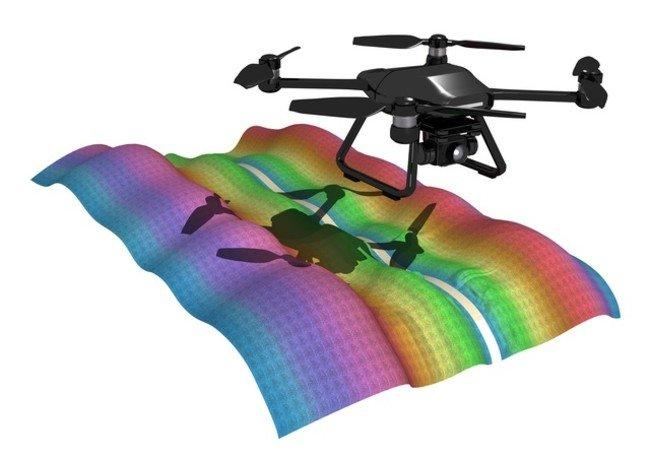
■Anyone can create a terrain-following flight plan quickly and easily Surveying with LiDAR-equipped drones is spreading, but there are already some issues in the field. This time, we first focused on one of these issues, the creation of a flight plan, and aimed to solve it. LiDAR surveying with a drone achieves high accuracy by flying at a constant distance from the ground surface and acquiring data. To do this, a three-dimensional "terrain-following flight plan" that conforms to the terrain's unevenness is required, which usually takes about 1-2 hours, and requires time and effort such as using different tools. This app has been developed so that anyone can create such a flight plan "quickly" and "easily". We aimed to realize “leveling of drone operation by IT” in this work. ■ The purpose of the trial - From the user's voice, to further "want to use" - In this trial, in order to develop functions that further meet the needs of the site in the future, surveying will be conducted on site using a LiDAR-equipped drone. We aim to get valuable feedback from our users. We will use your feedback not only for this app, but also for future planned new feature development.
If you set the flight range and altitude, the app will automatically calculate and create a flight plan according to the terrain. Since the flight plan created is KML data, it can be imported as it is to the flight control application.
Features of the terrain following flight plan creation web application- Intuitive and easy operation
- A minimum of 10 minutes to create a terrain following flight plan
- No installation required, web Can be used with a browser
・Number of applicants: No upper limit *If there are a large number of applicants, the reception may end early
・Fees: Completely free during the trial period (communication costs, etc. will be borne by the user) *You will not be charged automatically after the trial period ends.・ How to apply: After confirming the terms of use, please fill in the necessary information from the application form on the dedicated page (https://flights-construction.com/app/) and send it.・Application deadline: Until March 25, 2022 ・How to start using: An invitation link will be sent to the email address you applied within 2-3 business days after submitting the form.・ Participation conditions: Those who agree to answer the questionnaire sent after the start of use * Please check other detailed conditions on the dedicated page before applying. ■Development Plan FLIGHTS is currently planning to develop the following functions and services.・Creation of terrain following plan by Waypoint flight ・Addition of figure-of-eight flight (calibration flight) before and after flight ・Addition of annotation function (description of installation location of anti-aircraft signs, etc.) ・Creation of deliverables of i-Construction/public survey Addition of services, compatible equipment, and sensors that make it easier * In addition, we plan to improve and add functions based on feedback from trial users. Please feel free to let us know your opinions and requests in the questionnaire after the start of trial use. ■Development policy Since 2016, FLIGHTS has been operating drones in a wide range of fields, including surveying, inspection, agriculture, and aerial photography. Among the many drone-related companies, there are only a few companies that even handle the "operation" of "LiDAR". The FLIGHTS app is born from our unique know-how that combines “LiDAR”, “Drone” and “Operation” obtained from such valuable and abundant field experience. Future application development aims to be a service that comprehensively supports the operation of drones and LiDAR, and will contribute to the further promotion of IT at construction sites.All the apps and functions we develop are not just "convenient tools" for problem solving, but also serve as a window for collecting "potential problems of users" in the field of drone surveying. By listening to the voices of people who use the app and developing functions to solve new problems, we will continue to create “things that are easy to use for everyone in the field”.
With the vision of "becoming a company that contributes most to the creation of a society based on drones and robotics", we operate and introduce drones in the infrastructure inspection, surveying, and agricultural industries, and develop software. Utilizing the drone operation know-how and achievements that we have accumulated since the company was established, we will collaborate with partner companies that have knowledge in various industries to develop our business. Company name: FLIGHTS Co., Ltd. Location: 6F Dogenzaka Imai Building, 1-19-12 Dogenzaka, Shibuya-ku, Tokyo 150-0043 Representative: Shuhei Togeshita, Representative Director Established: March 4, 2016 URL: https://flightsinc.jp / FLIGHTS Spatial Information Division Email: info-sokuryo@droneagent.jp Dedicated page (free trial application form): https://flights-construction.com/app/- Press release >< /li>
- FLIGHTS Co., Ltd. >
- Starting a free trial of a terrain-following flight planning app that greatly improves the efficiency of drone LiDAR surveying [FLIGHTS Co., Ltd.]


![[Kill personally developed games] Top class in app history! Too beautiful water puzzle "a [Q] ua" | Famitsu App for smartphone game information [Kill personally developed games] Top class in app history! Too beautiful water puzzle "a [Q] ua" | Famitsu App for smartphone game information](https://website-google-hk.oss-cn-hongkong.aliyuncs.com/drawing/article_results_7/2022/3/3/66755df992ff2d2b1e1ab43844ef9f88_0.jpeg)


![[Latest in 2021] 10 recommended seat covers for cars!If you want to improve the texture and functionality of the car, choose the mounting type and material. [Latest in 2021] 10 recommended seat covers for cars!If you want to improve the texture and functionality of the car, choose the mounting type and material.](https://website-google-hk.oss-cn-hongkong.aliyuncs.com/drawing/article_results_7/2022/3/3/e5b44589e77141f3a633189165fb6f60_0.jpeg)